GPS/Chart Plotter with most of Florida for only $9.99 (long)
Posted: Mon Jan 04, 2010 8:50 pm
Ok here is my latest find. First of all I don't work for Apple or Navionics. If you have an iPhone or need to be able to cost justify one here it is. I told my wife it would make it easier for the Coast Guard to find her boys.  It worked.
Navionics has an app for iphone that includes the charts from just below Cedar Key down to the Keys and back up to South Carolina. All included for the one time cost of $9.99. Amazing. The entire US/Carribean is available for additional $9.99 charges for each chart zone.
Here are some screen shots of the functions.... It works in typical iphone fashion with touch and tap navigation. Flawless IMHO. It refreshes and tracks faster than I can change channels on the T.V.
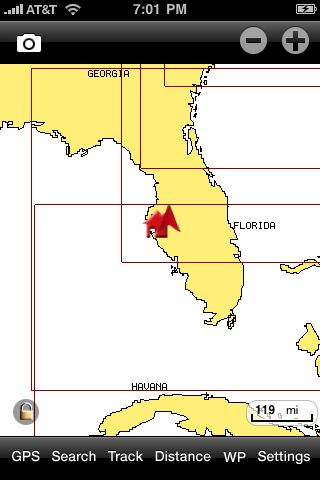
Tappin the screen or using the + / - at the top lets you zoom down from 10,000 feet to the top of a greenback's dorsal fin.
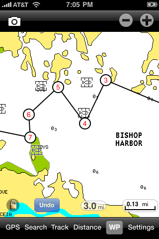
You can tap and add way points for navigation and route back...or to mark a productive spot. You can also drop pins and add photos/comments to favorite spots.
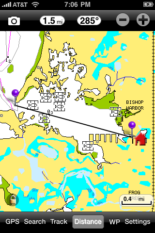
taping the distance field on the bottom displays two pins that can be dragged apart and placed on locations. The distance is displayed up top with a compass heading. You can also tap distance from current GPS spot. Funny how paddling a mile can seem like 5 into the wind. This feature is great for putting a ruler to that distant spot.
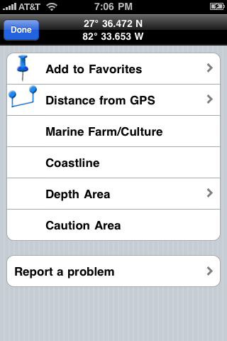
Screen shot of detail menu
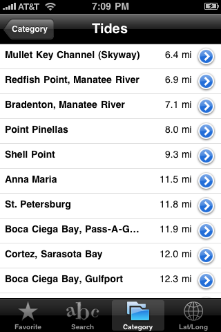
Tide prediction by location and distance from current location.
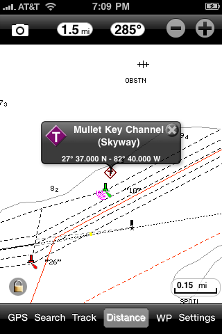
Tappin on the "T" icon for Tide gives you the following detail...
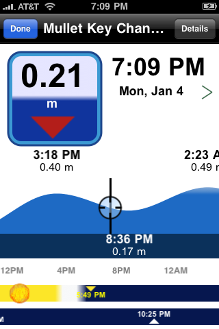
the black circle/crosshairs are slidable and move along the the blue tide curve, the sunrise sunset info changes as well.
The static screen shots really don't show the functionality of the app. These are just some highlights. For under 10 bones its a deal. I have my iphone in an otterbox case (water resistant sorta) then slip it into a west marine electronics waterproof pouch. The touch slide/tap screen is still functional. The pouch comes with a lanyard and I put it around my neck.
Additionally, the tracking feature draws a real time red line across the chart tracking your paddle. Good for the those "heavy mangrove get lost easy places" like 10,000 Islands.
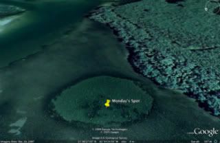
This might be cheating and or obvious, but using Google Earth you can zoom in on holes/structure and grab the Lat and Lon enter it into the iphone and start paddling. Could make finding holes easier when visibility is down, wind up etc....
Navionics has an app for iphone that includes the charts from just below Cedar Key down to the Keys and back up to South Carolina. All included for the one time cost of $9.99. Amazing. The entire US/Carribean is available for additional $9.99 charges for each chart zone.
Here are some screen shots of the functions.... It works in typical iphone fashion with touch and tap navigation. Flawless IMHO. It refreshes and tracks faster than I can change channels on the T.V.

Tappin the screen or using the + / - at the top lets you zoom down from 10,000 feet to the top of a greenback's dorsal fin.

You can tap and add way points for navigation and route back...or to mark a productive spot. You can also drop pins and add photos/comments to favorite spots.

taping the distance field on the bottom displays two pins that can be dragged apart and placed on locations. The distance is displayed up top with a compass heading. You can also tap distance from current GPS spot. Funny how paddling a mile can seem like 5 into the wind.

Screen shot of detail menu

Tide prediction by location and distance from current location.

Tappin on the "T" icon for Tide gives you the following detail...

the black circle/crosshairs are slidable and move along the the blue tide curve, the sunrise sunset info changes as well.
The static screen shots really don't show the functionality of the app. These are just some highlights. For under 10 bones its a deal. I have my iphone in an otterbox case (water resistant sorta) then slip it into a west marine electronics waterproof pouch. The touch slide/tap screen is still functional. The pouch comes with a lanyard and I put it around my neck.
Additionally, the tracking feature draws a real time red line across the chart tracking your paddle. Good for the those "heavy mangrove get lost easy places" like 10,000 Islands.
This might be cheating and or obvious, but using Google Earth you can zoom in on holes/structure and grab the Lat and Lon enter it into the iphone and start paddling. Could make finding holes easier when visibility is down, wind up etc....
