

Executive Summary
As many of you are aware a dabble in the stink pot on occassion, and I have pretty much relegated it to my grouper/tarpon/trolling/Skyway boat. Frankly this Sonar unit is pretty much overkill for just about all but the most tech hungry kayakers. With the water we typically fish this unit is probably way to much a gizmo, but for the kayakers with a powerboat this might be a useful review.
Details
I had been fishing a cheap Humminbird unit that is about 8 years old. It's adequate for finding bait and what not, but I wanted a combo GPS unit that had side imaging as well as down imaging. Mainly because I felt I was missing out on some spots that I had to be on top of to "see". With side imaging I could expand my room for error by about 200'. The concept being I want to maximize my time on the water and scouting empty water is a time killer. Then there's the I'm going from TPA to the Keys via the stinkpot with my kayak, but that's another story for another day.
For the river kayak guys this might be a cool toy, but I seriously don't see it being a fit - unless that's all you do and REALLY want to get to know every inch of the water. "Hey there's a tree 50' to the port side.
This isn't a "cheap" unit, but it's certainly on the lower scale of side imaging sonar. I got mine for $800, but on Black Friday you could have picked it up for $750 from Cabelas (or the cost of a decent used kayak). I had it installed at TA Mahoneys. You can easily hit $2-3K on this stuff.
The unit itself is feels relatively sturdy, and it got a work out in some heavy chop in 15 knot winds. I had to have an extra ram sonar holder added to hold the unit, but it does give me a bunch of flexibility moving it around.
At first glance the menus are pretty darn daunting - there's a basic menu and advanced menu. Fortunately my unit came with the DVDs and manuals, but more importantly the Wonderboy unit seemed to be the best option. I cut him loose on it when the fishing was slow and like all teens with a smartphone he figured it out really quickly.
I'm really impressed with all the readouts and multiple screens for views - top imaging, side imaging, navigation...I would say there's about 8 of them. The ice fishing one was pretty useless, but fortunately you can customize the menus to drop it off the view menu.
I like the GPS unit a bunch and it's a huge improvement over my handheld which will now be relegated to the kayak (Doublebranch here I come).
Below is a sample shot - on the starboard side is the boat ramp at Williams Park. Not that I couldn't see that, but it shows structure pretty nicely. You can see I turned the boat on the second ramp as the image curves. Each of the dots is a post and you can clearly make out the ramp and where it ends. On other shots I was able to see skeg trenches in the mud about 80' off port. The middle gold beam is where the boat is. Pretty nuts.

One major knock I have on the unit is that I had to download an opensource 3rd party viewer to look at the "movie" of the track I recorded. Seems silly that they don't provide that out of the gate - best I can figure it gives you every detail you would every want to know and they are worried about reverse engineering their product.
So far I can say I'm pleased with the unit, Wonderboy thinks it's the coolest thing ever, but I want to give it 6-12 months before I say - yeah it's really cool. Couple cons - when turning at running speed the depth may give you inaccurate results. Wonderboy said that the trolling motor caused some interference too. My transducer is on the starboardside, so port side objects are a bit more fuzzy with under way.
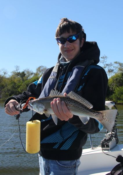
We did manage to catch and release several trout in less than ideal conditions (see below) - 12-15 knots, 50 degrees, but that had less to do with the unit than us getting in good water. Marking the spot was pretty easy, but heck I committed it to my memory on where we were. We did see a bunch of reds, but all had lock jaw. Yeah...that's a rootbeer riptide paddletail in the photo. I also caught a nice one on a riptide firefly flats chub.
For those of you thinking - wow you can really see details on there, I agree. However, spotting fish other than a bait ball with this unit will probably be tough. We did see a dolphin on the screen, and the zoom factor was pretty cool, but I'm not expecting miracles. I'm really just hoping to find structure and then go from there.
Anyway I figured I would start a placeholder for the review and add items over time.